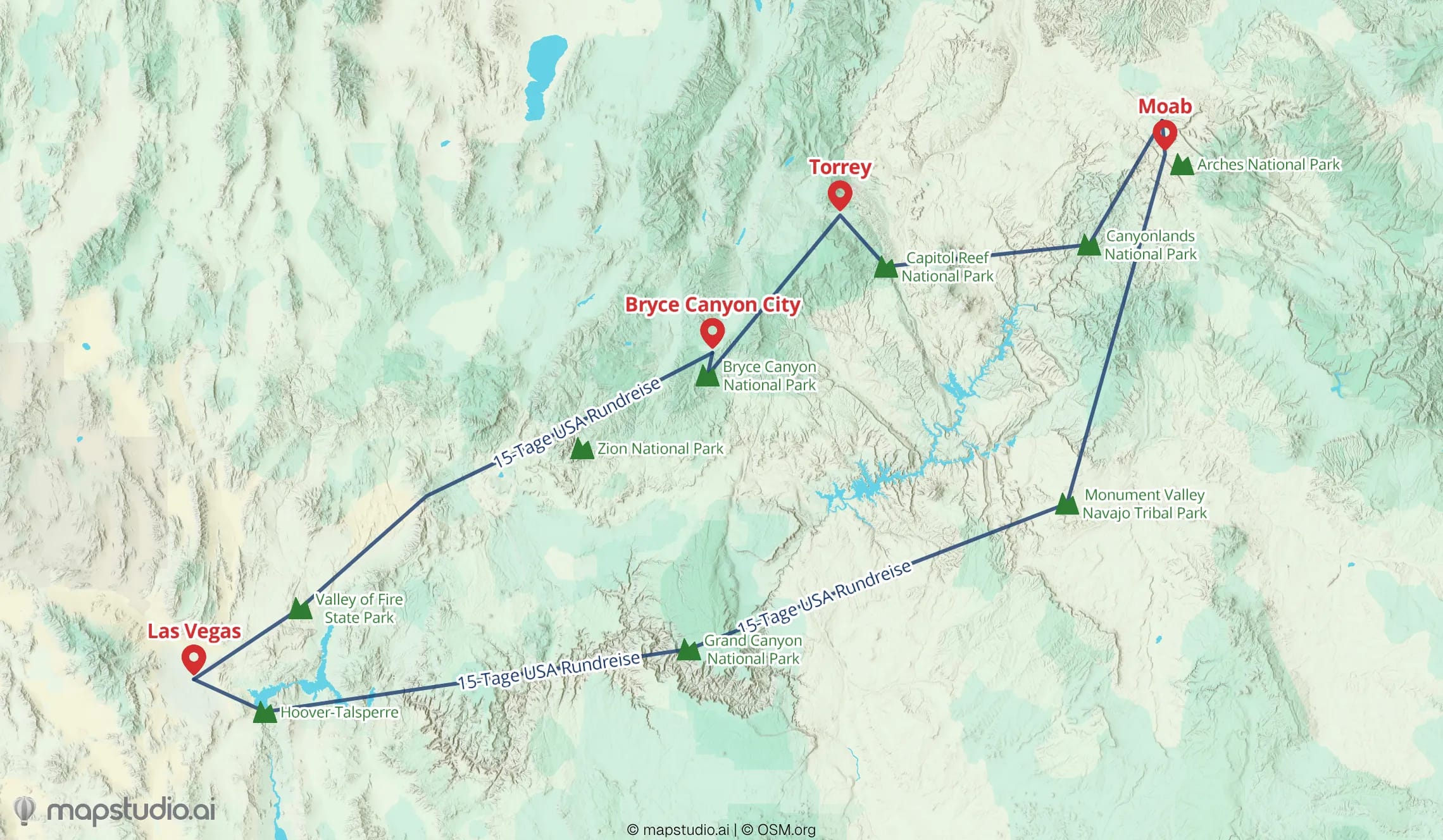
Hundreds of photos, one epic trip — but how do you turn the route into one image you can share or hang on the wall? Map tools are either too technical, or the result looks like a school atlas.
mapstudio turns your trip into a map you actually want to show. Type the route, pick a style, export. For the blog, the photo book, or a large-format print.
Typical task: put a travel route on a map
Describe the trip
"Road trip West Coast USA: San Francisco, Yosemite, Las Vegas, Grand Canyon, Los Angeles." — done.

Pick a style
Bold for the Instagram post, calm for the wall, black-and-white for the travel journal — switch in seconds.

Export or print
High-resolution PNG for the web. Print-ready PDF when you want the map framed on the wall.

Under 5 minutes from first input to a map you can share.
Built for travel memories
Type, don't click
Describe the route in one sentence — the AI places stops, lines and labels. No tedious point-by-point clicking.
Styles with character
Multiple map styles that actually look like travel — not like Google Maps. Switch per map.
Print and web export
PNG up to 5000×5000 pixels for blog or social. Large-format PDF when the map goes on the wall.
Pay-per-download
Creating and trying is free. You only pay for what you actually download — no subscription.