How do you visualize a travel route on a map?
Prepare the stops, describe the route in mapstudio.ai, pick a style, download as PNG or PDF. Under 10 minutes from the brief to a print-ready map for catalog or editorial.
Pay-per-download · Print-ready maps · Commercial license included
The short version
You can put a travel route on a map in four steps: (1) prepare the stops in order, (2) describe the route in mapstudio.ai using natural language, (3) pick a style that fits the catalog or magazine layout (Atlas, Relief, or Flat), (4) download as high-resolution PNG or print-ready PDF in CMYK color space. The AI handles geography and labelling, no GIS software, no design skills required.
Visualize a travel route in four steps
- 01
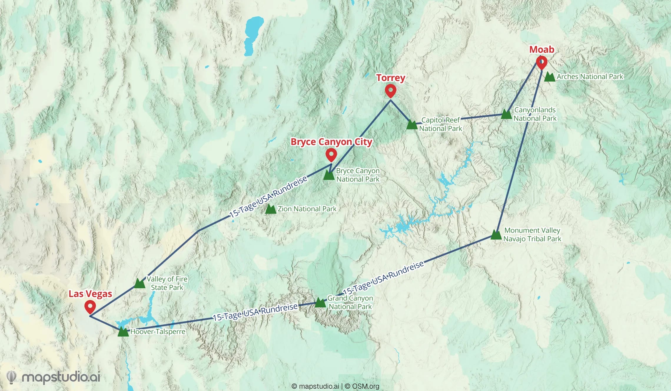
Prepare the stops
List the main places of the route in order: start, intermediate stops, destination. For travel-catalog routes, listing every overnight stay plus the most striking sights between them works well. For cruise itineraries, the port cities are usually the right stops.
- 02
Describe the route in mapstudio.ai
In the map editor, describe the route in natural language. Example: "Road trip US West Coast: San Francisco, Yosemite, Las Vegas, Grand Canyon, Los Angeles." The AI builds the map automatically, places the stops at their real geographic locations, and connects them with a route line.
- 03
Adjust style and details
Pick a map style that fits the occasion: Atlas for classic travel catalogs, Relief for topographic depth, Flat for modern editorial looks. In the editor, rename labels, move stops around, and adjust the color palette to brand colors. Save per workspace for a consistent look across all maps.
- 04
Download the map
High-resolution PNG (up to 5,000×5,000 pixels) for web and social, or print-ready PDF in CMYK color space for press. The download comes with a commercial license for print, digital, and ads.
What makes a good travel map
Less is more
5 to 10 stops usually suffice. Too many points clutter the map, especially in a catalog layout. For longer trips, split into multiple maps per route section.
Route style matching the travel mode
For travel-catalog road trips, a curved line following the roads captures the character better than a straight connection. For flight or cruise routes, straight or slightly curved lines between stations work, since the route doesn't follow roads.
Style matching the medium
A colorful Atlas style with clear labels usually fits a travel catalog. A more restrained Flat style works better for a travel magazine or image brochure. Save the brand style per workspace so every map for the same client stays consistent.
Check the labels
The AI assigns automatic labels for stops. Skim them and tweak when a place has a different local name (e.g. "Cinque Terre" instead of "Riomaggiore" as an umbrella term) or when the magazine has a specific spelling.