Maps for editorial features, ready by deadline.
From manuscript to print-ready map in minutes. PDF for press, PNG for web. Commercial license included. No GIS, no external cartographer, no subscription.
Pay-per-download · Print + web from one workspace · License for print and digital included
Story is ready. The map is missing. External cartographer needs three days, your editorial deadline is tomorrow.
mapstudio delivers editorial maps in minutes. Magazine-grade Atlas style, print-ready output, commercial license for print and digital. Iterations don't cost extra.
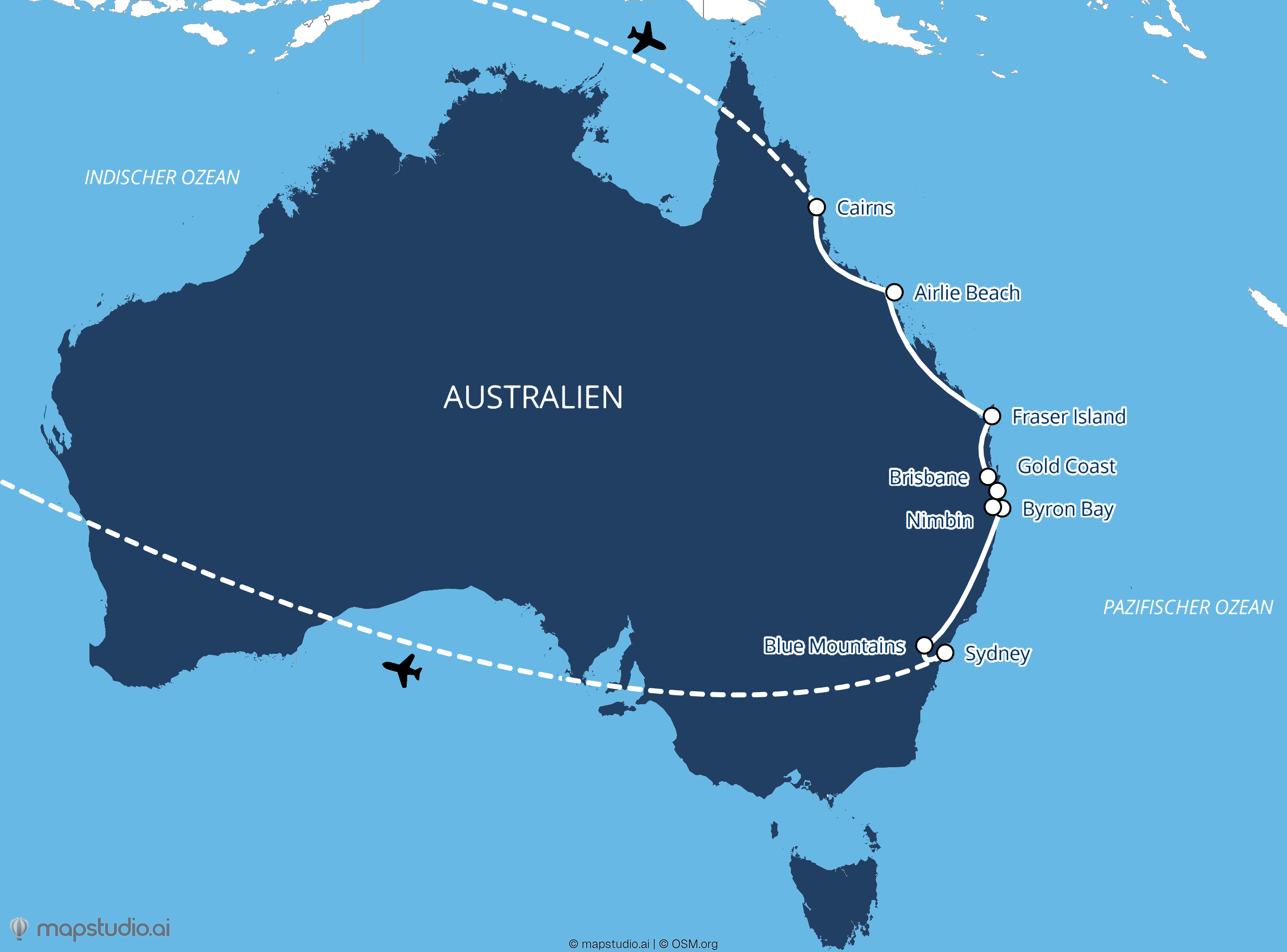
Typical task: East Australia feature for the special issue
Enter the brief
"East Australia: Cairns to Sydney, highlights along the coast", and the AI takes it from there.

Pick a magazine style
Atlas, Relief, or Flat. Adjust the palette to the magazine's CI, right in the browser.

Export print-ready
PDF for the press file, high-resolution PNG for the web edition. Both from one workspace.

30 minutes from brief to print-ready map. Iterations at no extra cost.
Built for the newsroom
Print-ready
PDF for the printer, high-resolution images (PNG, JPEG, WebP) up to 5,000×5,000 px for the web edition. Both included.
Magazine-grade
Atlas style with editorial polish. No generic Google Maps screenshots, built to match the visual language of premium travel magazines.
License included
Commercial license for print and digital, comes with every download. Covers ads and social as well.
Iterations free
Maps stay in your workspace. Re-edit, re-export, swap languages, without paying for a new download.